

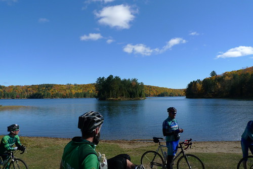
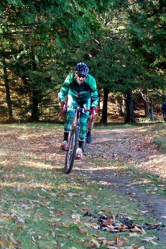
All right folks, bust your fattest CX tires out and get ready for the best CX ride of the season. Featuring road, trail, and Pipolinka, the route is an 85k loop.
UPDATE: GPS trace of Monday's route is up: http://ridewithgps.com/routes/
When is it again, where?
Thanksgiving Monday, October 10, 09:00, Gamelin Gate of the Gatineau Parkway. 09:00 is the departure time, so please arrive early enough make a donation to Bicycles for Humanity and receive your cue sheet.
So is it a race?
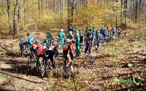
No, Double Cross is an un-race. Ok, so what the heck is that, you're asking? Think our Ride of the Damned format. Like the Ride of the Damned, Double Cross is all about creating the context where teams - in this case of 2 rather than 5 - can do whatever they feel works for them, be it ride full on, or more conversation pace. Its up to teams to decide what they want out of the ride. We provide the route and let everyone loose. There are no prizes for placing. Whoever finishes first will simply be finished, first.
Why teams of two?
Good question. Teams afford riders some security in the case of a mechanical, biological, or navigational. With this being an offroad ride on cross bikes, flats are a real threat. Teams of two means not too many folks are held up waiting for flat fixes, and its a lot easier to find one friend to team up with for a ride like this than more. It is fall after all, and a lot of riders have called the season a done deal. Ideally, you'll want to pair up with someone who you can ride your comfortable pace with. If your partner likes to bring along lots of spare tubes and tools, or say, cookies and whisky, that's good too.
Last year a we rolled as one big group in neutral start fashion to the Pine Road trailhead. At least that was the idea. This time we won't require a neutral start. Groups can form organically once we roll out. If teams decide to just ride their own pace, there will likely be some natural grouping along the way for various reasons. The issue with maintaining a large group is that everyone waits for every issue to be resolved, be it a flat or otherwise. So the whole ride takes a lot longer than necessary. If teams want to hang with other teams, I advise you to make your intentions very clear so everyone knows the plan.
If we have an odd number we'll form a team of three. Lets preserve the spirit of the ride.
How will the route unfold?
After some route testing over the summer, we've improved on the 2010 route to reduce pinch flat areas, including some of the areas degraded by heavy rains.
We will all roll from the Gamelin Gate to Mine Road. We'll work our way over to Scott Road, then Highway 105, which we will follow until the split to River Road. At this point, we'll continue on the 105 to Pine Road, turn left onto it, and continue straight onto the trail (#50). We'll take the 50 all the way to Lac Phillipe, then ride along the lake to P19. From there we'll take the 51, followed by a right onto the 53. This will lead us to the 53/52 junction, where we'll head left and downhill under the Highway 5, past Le Moulin, and deliver us to Pipolinka's door. Think of Pipolinka as a lunch stop in a randonnee or century ride. No rush, enjoy it.

When each team is ready to roll, head toward the Gatineau River and turn Right on River/side Road. Ride toward the train tracks, and as you reach them, head up to the Right on Rockhurst (stiff climb). Stay on Rockhurst, cross the 105, and continue straight as the road becomes Chemin du Lac Brown. From the Brown Lake cabins, head up the 57, and connect to the 52; turn left. Follow the 52 to the 50, turn Left, then follow back to Pine Road, and retrace your track back to the Gate, or wherever you need to go from there.
Now, there is an option for more dirt that can be exercised if desired. Rather than taking the 50 all the back to Pine road, teams can opt to head right, onto the 36. This section is rougher than everything else, so know that. It spits you out at O'Brien beach. Rather than having everyone take this route, which would simply be too much for many, I've factored it as optional. There might be faster teams and groups who'd like to meet up with slower ones at the end. This is totally doable by taking these two different last legs.
Please familiarize yourself with the map. We won't be providing any. Like a randonnee, some preparation is required on your part to know, as a team, where you are going. If you are not familiar with the trails in the park, this is a good opportunity to put your navigation skills to work. Its very hard to go wrong with this route, and there are maps around in the park to refer to. You can print the map above, or purchase one from any of the NCC information centres, or World of Maps on Richmond Road.
What happens at the end?
Nothing is prescribed here, many will be heading to Thanksgiving dinners. Those who don't have commitments after the ride may want to catch a drink and food afterwards. This will likely largely depend on the weather. In the event of rain, most will likely want to get home and into warm clothes. Its probably best to play it by ear and make plans on the fly.
If you bring a camera along, be sure to send a link to your photos afterwards. We'll put those up on the aftermath post.
Note:
Please remember that this ride, while free, is also an opportunity to devote some dollars to a good cause, Bicycles for Humanity. At the gate, Tall Tree Tanya (The Vegan Vagabond), will be collecting donations and handing out cue sheets. This will be your opportunity to make a donation. If you want to make a donation that is sizable enough to require a receipt, don't expect one, I won't have any. Such donations can be made online. Bring bills if you can, they're lighter!
Please feel free to post questions in the comments, or email me: talltreerides@gmail.com

3 comments:
nice route!
Esp through browns!
My partner bailed last minute, would have loved to be there.
Take note - trail 36 is under construction near the bridge as you climb before the hill... its still possible to pass though... leafers will be out full force trying to get across the narrow way and equipment they have spread out.
Post a Comment