Thursday, September 27, 2012

Double Cross 2012: The (not so) Skinny

Poster by Greg Cosgrove
All right folks, bust your fattest CX tires out and get ready for the best CX ride of the season. Featuring road, trail, and Pipolinka, the route is an 88k loop.

DSC00880

When is it where? 
Thanksgiving Monday, October 8, 09:00, Gamelin Gate of the Gatineau Parkway. 09:00 is the departure time, so please arrive early enough make a donation and receive your cue sheet. This year will will once again pass along your donations to Bicycles for Humanity, but we will also donate a portion to the Eastern Ontario Cyclocross Series for the purchase of cloth number plates (for the 2013 season) and/or some of the other consumables the races eat up (course tape, stakes, etc.). This is a great opportunity to share. This year's Ride of the Damned raised $1790.00! $1780.00 of which went to AFRICYCLE, and $10 to Canada Helps, via Bicycles For Humanity.

So is it a race?
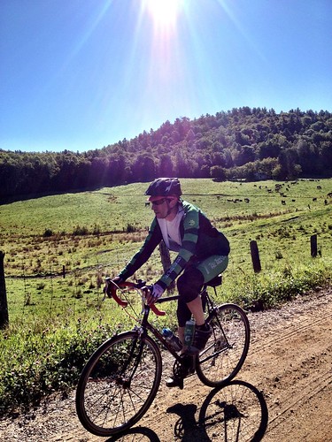
No, Double Cross is an un-race. Like our Ride of the Damned, Double Cross is all about creating the context where teams - in this case of 2 rather than 5 - can do whatever they feel works for them, be it ride full on, or more conversation pace. Its up to teams to decide what they want out of the ride. We provide the route and let everyone loose. There are no prizes for placing. Whoever finishes first will simply be finished, first.

Why teams of two?
Teams afford riders some security in the case of a mechanical, biological, or navigational.  Ideally, you'll want to pair up with someone who you can ride your comfortable pace with. If your partner likes to bring along lots of spare tubes and tools, or say, cookies and whisky, that's good too.

Groups will form organically once we roll out. If teams want to hang with other teams, I advise you to make your intentions very clear so everyone knows the plan.

If we have an odd number we'll form a team of three. Lets preserve the spirit of the ride.

How will the route unfold?
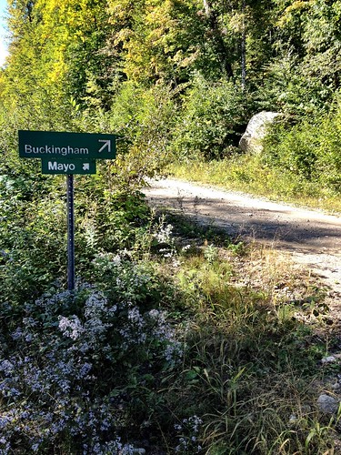
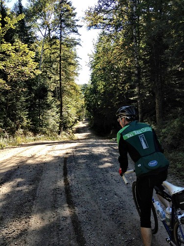
The 2012 route differs from the 2011 route in two spots. 1) I've included Schnob Road, which we will access by the covered bridge at the Lac Phillipe entrance. Schnob becomes trail #53, one that I think most will not have ridden before. I wanted to include it for that reason. 2) Highway 105 construction has knocked out the section of trail #52 from Mill Road to the 53. So we'll ride past the descent to the stream, and spit out onto the HIghway at P17. From there we will ride into Wakefield for goodies at Pipolinka. 


We will provide very basic cue sheets to each team. If you wish to create your own more elaborate version, please do. This is a good exercise for those who aim to do rides like D2R2the Kearsarge Klassic, or any other randonnee. Since the map above doesn't provide trail numbers, you'll want to use the Gatineau Park map in tandem. Please familiarize yourself with the map. We won't be providing any. If you are not familiar with the trails in the park, this is a good opportunity to put your navigation skills to work. Its very hard to go wrong with this route, and there are maps around in the park to refer to. You can purchase the Gatineau Park map from any of the NCC information centres, or World of Maps on Richmond Road.

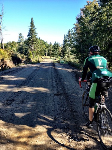
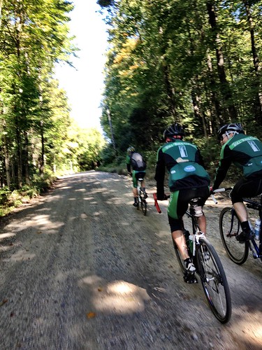
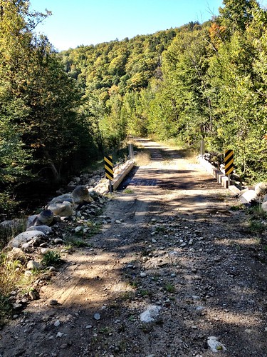
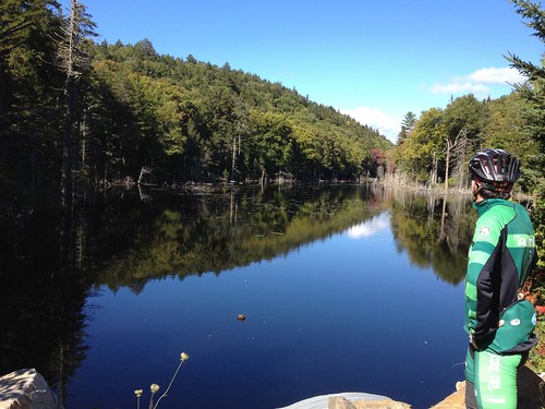
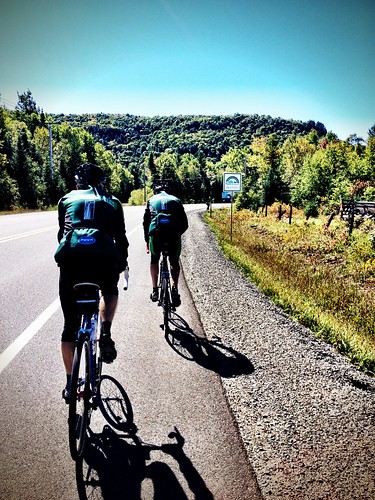
We will all roll from the Gamelin Gate to bike path at the base of the Pink Lake climb to Mine Road. We'll work our way over to Scott Road, then Highway 105, which we will follow until the split to River Road. At this point, we'll continue on the 105 to Pine Road, turn Left onto it, and continue straight onto the trail (#50). We'll take the 50 all the way to Lac Phillipe, then ride along the lake to P19. Continue on the road to the Covered Bridge, and turn Right on Schnob (before crossing the bridge). This will become the 53, which we will follow to P17. Do not head left and downhill on the 52 under the Highway 5. From P17, head Right (South) on the 105 for a quick jog to Chemin Valley. At the T-intersection, turn Left, then Left again at the Hibou to get to Pipolinka in the back, along Mill Road. Think of Pipolinka as a lunch stop in a randonnee or century ride. No rush, enjoy it.

To return, head Right (South) on Chemin Riverside / River Rd. to Rockhurst, and follow that to and across the 105. You will head straight to Chemin le Lac Brown. At the fork, stay Right/straight. You will descend to the cabins, and head Right, on the 57, then Left on the 52. Stay on the 52 until the T-intersection with the 50, and head Left. This will take you back to Pine Road, where we entered the Park from the 105. Retrace your steps from there.

What happens at the end?
Nothing is prescribed here, many will be heading to Thanksgiving dinners. Those who don't have commitments after the ride may want to catch a drink and food afterwards. This will likely largely depend on the weather. In the event of rain, most will likely want to get home and into warm clothes. Its probably best to play it by ear and make plans on the fly.

If you bring a camera along, be sure to send a link to your photos afterwards. We'll put those up on the aftermath post.

Note:
Please remember that this ride, while free, is also an opportunity to devote some dollars to Bicycles for Humanity and the CX series. At the gate, I will collect donations and hand out cue sheets. If you want to make a donation that is sizable enough to require a receipt, don't expect one, I won't have any. Such donations can be made online. Bring bills if you can, they're lighter!

Please feel free to post questions in the comments, or email me: talltreerides@gmail.com

Tuesday, September 18, 2012

Tour des des Laurentides et des Outouais - Fables and foibles

So I got this idea in my head after last year stumbling across an essentially similar route posted by a friend (who never did end up doing it) on ridewithgps.


The window of opportunity opened for me this last week of August 2012 and the weather forecast was making that window sparkle....so with a borrowed set of panniers and rack it was a relatively last minute, minimal planning, “just do it” adventure. Now of course that being the case there were a few typical little snags and adversities - but all were managed !

1) Installing the rack the night before leaving - snapped a bolt in the stay lug just above the derailleur. Luckily a friend lives close by with all the appropriate tools to help out in this case and after a bit of work - got ‘er done...Thanks Ian !

2) I wanted to follow the actual Route Verte to Laval and up to the start of the p’tit train du nord, now the route verte website is really kind of crappy from a user perspective so was up til 5 am trying to cut and paste screenshots of various sections of the winding route through Laval and get them printed....not too much sleep for what I had planned to be a 170 km day !

With an eventual 12:20 departure, tentatively rolling along the western pathway with 35 extra pounds on my rear axle I had little faith in actually arriving at my intended destination (Oka park). So far so goo though, and every km I tick through Ottawa and Gatineau towards the 148 East instills a bit more confidence. Most of the route is path til east Gatineau then the 148 to Masson is not too bad. Masson to Montebello however sucks rocks...lots of fast big traffic including logging trucks....I REALLY hope it is not like this all the way to Laval !!

3) The next snag turned out to be a couple of loose spokes...in the rear wheel of all things, my Stans 24 spoke CX race wheel - (ya foible number 3 - did not think to put my old heavy duty mavic wheel back on the bike). Nevertheless I managed to get that fixed up in Montebello, and with the spokes tensioned of course the wheel was a bit out of true, so a bit more work to make that manageable. Riding after that just felt more solid and confident !

Riding east of Montebello was a real pleasure - very light traffic and lovely hills to the north, meadows to the south. The actual route verte takes a few turns but as dusk was aproaching I stuck mostly to the 148 and 344.


4) Next foible - a little niggle in the left knee....only 120 k into a 670 ride...!


Stopped at dusk for pizza in Sainte Andre with about 30 k to go to Oka. Decided to stop now as I did not think there would be much open down the road and had no intention of cooking after a long day. 1.5 hrs riding in the dark (augmented with moonlight) in the very light traffic was quite fine. Arrived at Oka park at 9:30 and just set up tent in a small clearing in some bush.


5) After a fitful 4 hrs of sleep I woke to ....you guessed it...a flat...on the rear no less. Pumped it up and it held for a while but slow leaked. Finding a decent spot to effectuate my tube change at the east park gate I discovered a tiny wire in the tube (never seen something stay in the tube before -usually it stays in the tire). Got that fixed up but then discovered (foible number 6) a loose cassette, for this I need a shop. The very helpful girl at the desk mentioned that there was a shop about 7 km up the path in Sainte Marthe sur le lac. Got that fixed up lickety-split and on my way again on a beautiful sunny (albeit windy...again) day !


Rode through some lovely neighborhoods in Laval. Took a bit of getting used to the bike lanes in the opposite direction of vehicle traffic...a little disconcerting with opposing traffic turning right (almost into me), all manner of skateboarders, walkers, rogue squirrels and bikes all over the lane. The tour de Laval took me to Bois de Fillion where I stopped for lunch and the start of the p’tit train....it is actually the -30 km mark as the zero km mark is up in St. Jerome. I did get off track at one point and got the GPS going to get me back to the track in Ste. Therese at the -17 km mark. Heading north out of Laval is quite nice with lovely green fields and meadows, the beautiful Riviere du nord...of course the nice weather helps but the wind is now in my face and even the smallest hills felt tough with the weight. Felt pretty cooked for the last 20 km and finally found the campground at Val David 4 km off the trail. Shower, steak, wine, beer...ahhhhh !


Day 3 is the shortest day (100 km) and the only one completely on the p’tit train du nord. 12 noon departure with blue sky and a plan to soft pedal flats and downhills and spin uphills in order to preserve my knee from that niggle that appeared on day one. The omnipresent wind however (while not too too strong) was nevertheless unrelenting.

Foible 7 - well not really a foible but shortly into the ride a bit of a concern regarding tingling numb fingers...had not experienced this on other days so was wondering why so early into today’s ride. Also on this day I started to feel this weird blissfully ethereal somewhat hypoxic sort of out-of-body state on the bike, similar to a nice cool buzz. I even thought a few times that I might keel right over to the side while riding. Not sure whether to attribute that to three nights of crappy (quality and quantity) sleep or the “Arthur’s green energy” smoothy I had before take-off.


This day brought some beautifully idyllic meadows, fields and pastures, lovely rivers, rapids and tree covered hills, even a turtle crossing. There were also some rather forgettable sections, particularly km 57-67 ish which is mostly along the 117 and quarries. At km 67 was a nice (finally) downhill...it is amazing how even a 2% grade lets one fly downhill with 35 extra pounds strapped to one’s ass - of course the uphills at even such a shallow grade are thusly accentuated ! As I approached Lac Nominingue I had to use some half-assed rusty french to get directions and the info I needed. People were mostly very helpful.


Day 4 - 9:55 departure - forgot water bottle 5 k up the trail, return, 10:20 departure. Some grey clouds interspersed with occasional tranches of blue. Today I had none of the finger fuzzies, but there were a lot of dive bombing jays and some crazy (sorry - PC - “emotionally unbalanced”) squirrels. My old friend the wind hitherto came again ! While the remaining trail is asphalt, some sections here are alas reminiscent of typical Quebec roads. There are some great views but many are obstructed by trees along the trail. At Mont Laurier I was on a desperate search for ham and cheese on a croissante...mission accomplished and after some chill time headed off on the 117 west. The next 7 k were thoroughly unenjoyable with the quadrefecta of traffic, hills, wind and construction. Next 10 were reasonably decent with paved shoulder, traffic was likely exacerbated by the impending long weekend. Lots of big honking land yachticals towing big honking motor boaticles.


At 107 south there is no shoulder, crappier road and shorter steeper hills, but there is less traffic (save for some teenage pustules of discontent driving their wanna be formula one frankenmobiles), and was maybe more sheltered from the wind. Alas my old nemesis the wind spared little mercy...peut-etre un petit peu. Cependant, j’ai bien profite’ du grace a’ on ami Monsieur Soleil !

Eventually to Maniwaki (my first time there) and on to the veloroute des draveurs. The first 15 k is essentially unmaintained by the municipality as it goes through Kitigan Zibi Indian Reserve and is used by trucks, ATV’s etc. As I’ve been known to like a little adventure with my adventures I figured what the hell. While it starts paved in Maniwaki it switches quickly to gravel then compacted sand, some parts smooth, others a rutted pitted minefield requiring adept navigation and mental concentration. I stopped along a lovely lake with impending gorgeous sunset and considered commando camping there. But it looked like well used by the local yutes on dirtbikes / quads with beer and bonfires. Not knowing how appreciative said yutes might be to a pale interloper squatting on their land I decided press on to Lac Grenon. Basically this is mostly a seasonal RV camp but I was afforded a nice patch of grass near the water and after a massive wind whipped up, later settled to a peaceful starry night.


Day 5 was perfect weather, this time 70% blue sky interspersed with puffy white clouds. Stopped at the Pinewood restaurant in Low for a DEEEEE-licious BELTO on rye, (bacon, egg, lettuce, tomato and onion). Then down the 105 for a ways to Farrelton where it was decision time....decided to rid myself of the highway and continue the adventure on the east side of the river. While the gravel itself was pretty decent, the underlying washboard was somewhat disconcerting given the 35 extra pounds on my rear and a diminishing supply of tubes. Eventually came out to the Wakefield covered bridge (upon which a wedding was occurring), and waited for the “walk down the isle” to finish before proceeding across in the remaining space as innocuously as possible. Ran into Neil here and he snapped this fuzzy (but only) photo of me on the trip.


From here there is still a ways to get home but I really feel like it is my “backyard”. Some Pipolinka baked goods, then down to Chelsea, through the park, back to the mighty Ottawa river and finally home to Britannia. A long day and longer journey fulfilled....topped off with Baja Burger and beer on Britannia beach...what more could one want !?

And so another moderate adventure filed away in the annals of Mike’s repertoire.
A’ la prochaine !

(Day 2 and 4 the profiles are actually reversed...and the order below is day 5 first then down to day 1...yes as you can tell this IT stuff is not my forte'!)


Grant's Folly: Pass the Mayo

Camera Roll-430


"Guys, why don't you try out the route I was thinking of doing a gravel race on?"

Sure, why not. For the last Sunday before cyclocross kicks off at Calabogie on September 23rd, why not ride some gravel Grant's been whispering about. I sketched out an extended approach to his 100k loop, bumping the distance up to 160k, but in the end, Pascal, Rodd, Chris and I agreed it would be more prudent to tackle the 100k alone, you know, in case there were issues.

Camera Roll-443


Our launch point was Mayo, a hamlet the barely registers on the map, about 30 minutes drive from downtown Ottawa. Right from the go the landscape was beautiful. Nice cottages, views, a river, all very pleasant. Within no time we were on gravel and ascending. Cottages became farms, then we left civilization behind. We were in Papineau-Labelle.

Camera Roll-434
We were supposed to follow the driveway these beasts were guarding to a maybe-road
further on.....ummmm, pass.
Camera Roll-441


A  year or two ago I had an idea: ride to Tremblant from Ottawa on gravel roads via the Papineau-Labelle Nature Reserve. P-L does not show up on google maps or other mapping media we commonly use. I had to dig to find information on the Reserve, which included purchasing a backroads mapbook from the World of Maps on Righmond Rd. The Reserve appeared massive, but what were the roads and trails really like? Was the route I'd highlighted in the book even rideable?

Camera Roll-438


Pascal and I drove out one Saturday to do recon. We turned off the 309 and soon got into some pretty gnarly stuff. Baby-head rocks and lots of rough stuff. Not for all-road bikes, we concluded. 29ers, sure. So we aborted the plan and that was that.

Camera Roll-433


And then we were there. Following Grant's sketch, we were heading north on 'Route 1.' Backwoods, nothing but us and the road. I felt exposed, and I mulled over the sensation. We rode lots of dirt and gravel, why did this feel weird? Because there was nothing but the road, nothing for a long way. No signs of civilization aside from the odd boat locked by a lake, and, of course, the road itself.

Camera Roll-431


Then there were trucks. Barreling down on us as we rode across the road. "CAR!" We dodged out of the way as the driver hit the brakes hard, skidding. Everyone fine, we rolled by and exchanged regrets; neither of us expected to see anyone else. Difference is we won't likely crush anyone with our bikes. The big white twincab pulled an atv and guns, as did his buddy behind. Great, hunters.

Camera Roll-429


We cut onto Route 2 heading West and soon encountered more hunters. This time, sight lines were long. The first of two stopped to ask for directions to Kennedy Lake. We moved back to speak to his buddy in the second truck, sipping a beer, then a Red Bull. Comforting. On we went.

Camera Roll-426


We knew we neared the highway as the road transitioned to hard pack. The downside to this surface is that rocks are now embedded, which tends to mean they cut tires. Sure enough, an invisible offender knicked my Grand Bois, deflating my precious latex tube. My spare suffered the same fate once aired, as I'd assumed I'd pinched, so in went the butyl big boy. "We're taking the highway back down." It was already getting into mid-afternoon, I was down two tubes; we'd had enough fresh tracks for one day. Agreed.

Photo 4 - 2012-09-17


A casse croute stop along the 309 satisfied the guys' hankering for grease. My fries were less than inspiring, but not offensive enough to inhibit the return leg of about 50k on the highway, repaved last year with a generous shoulder. Directions from a francophone local sporting an Winnipeg Jets shirt (tricked Chris into thinking he was anglo) helped us finish off the loop on backroads rather than more highway.

Camera Roll-421


Camera Roll-420


Photo 3 - 2012-09-17
Snowbirds bedazzling the sky


At the end of the day, the route was certainly different, but the feeling of exposure, not to mention lateness (stressing about getting home at a reasonable time always kills a ride's appeal) detracted from the positive vibes of the ride. Not all 'out there' routes are equal. Jan Heine rides a lot of old access road in the Cascades. I've never read him report encountering hunters driving pickups while the swilled beer. If one of us suffered a fatal mechanical, or significant injury, it'd be a looooooong time until we could bring the cars around. The trick seems to lie in plotting routes that include great terrain while not being totally off the grid. Cell service is pretty handy, for example. As event organizers, we have to think about all the stuff that can go wrong, and gauge management of risk. Papineau-Labelle falls into the 'only on BIG tires, only with hardy types' kind of place to ride. In the future, we might ride through the park to connect other stuff. But that'll be on 29er or monstercrossers, and we'll be keeping an eye for hunters and fishers, and hoping not to get shot.

Here's the first leg, followed by the second. I had to change courses on my Garmin, on account of our disinterest in trying the road guarded by the menacing cast of beasts above. The whole thing is here.